shedder
Active Member
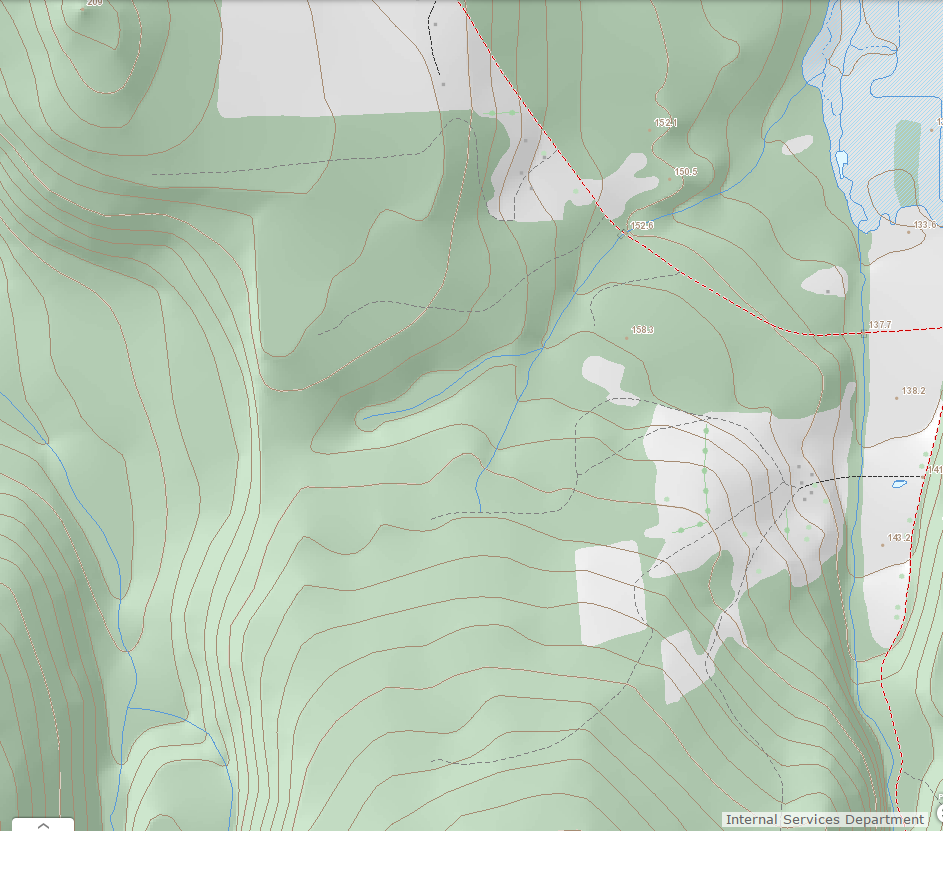
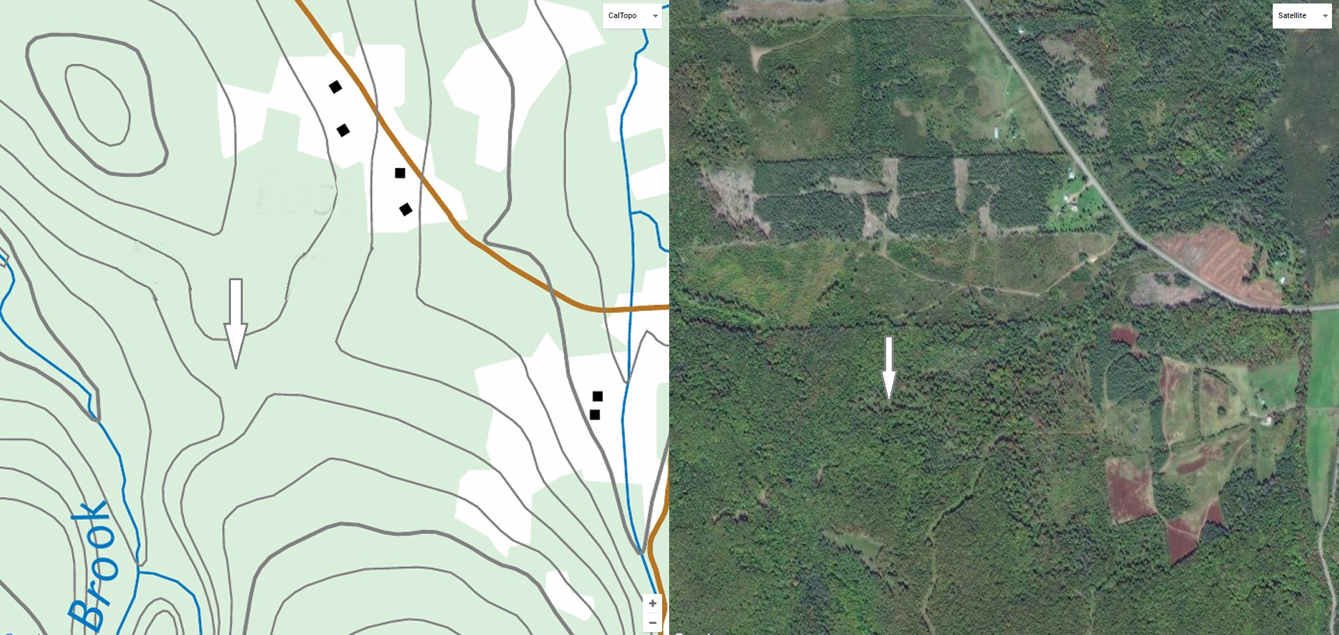
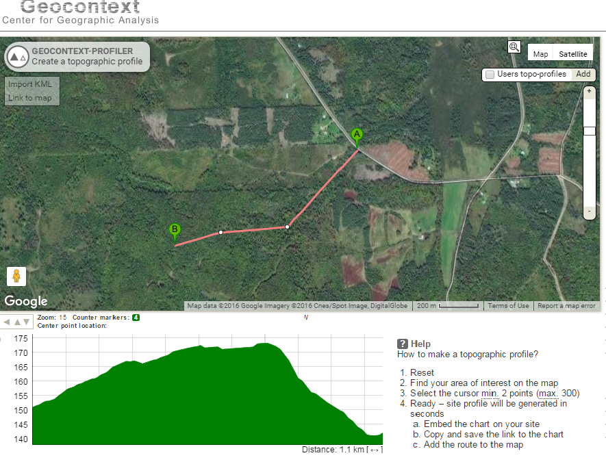
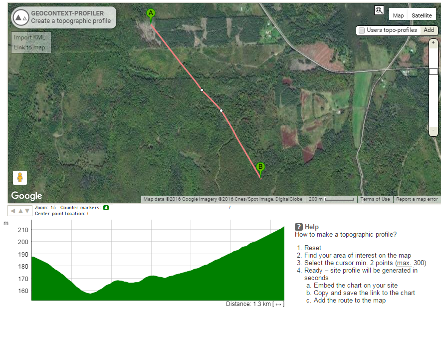
When does a saddle become useful to a buck?
How much elevation drop does it need?
In the example above, the NE running brook has cover and acts as a minor cover funnel but is the saddle significant enough to matter?
I don't know if it is used. I haven't checked it. The blue top right is a 40 acre alder swamp. There are wild apples near there, too.
The contours are metric but they equal 15 feet.
Last edited: